

This story was supported by a grant from the Pulitzer Center.
Inside a tent fastened to the surface of Greenland’s ice sheet, the members of the GreenDrill expedition huddled around a drilling rig. The machine whined and shook as it spun. For days the drillers had been inching through ancient, solid ice to reach the rock below.
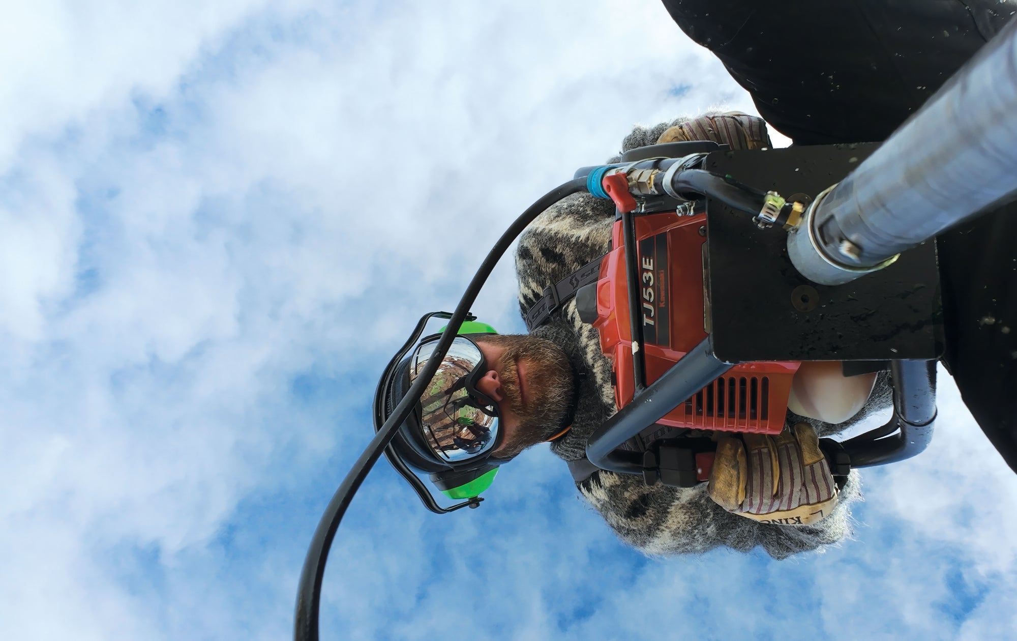
Outside, the sun burned down through a cloudless sky. The wind, having tumbled down 4,000 feet of elevation from the domed summit of the ice sheet hundreds of miles to the west, charged over the surface in wavelike pulses. The tent shuddered like some mad bouncy house at the end of the world. The nine members of the expedition—ice and rock engineers, scientists, polar-survival specialists—knew they should be close to bedrock. But Forest Harmon, the driller working the handwheel, said he still couldn’t feel the core break—the moment when the metal catcher inside the drill head separates the bedrock core from its earthly tomb.
On supporting science journalism
If you’re enjoying this article, consider supporting our award-winning journalism by subscribing. By purchasing a subscription you are helping to ensure the future of impactful stories about the discoveries and ideas shaping our world today.
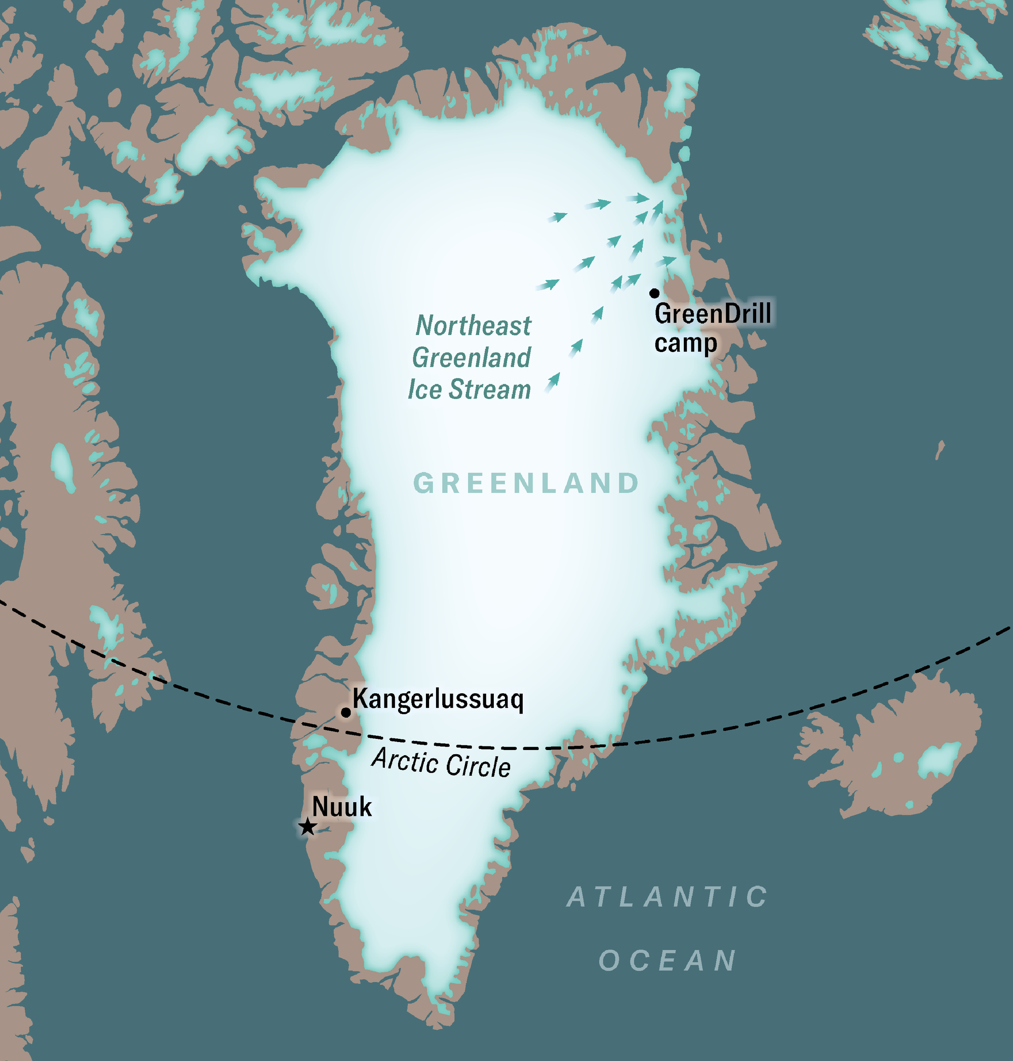
The GreenDrill site sat on the frozen edge of the Northeast Greenland Ice Stream, or NEGIS, a massive, moving tongue of ice that drains 12 to 16 percent of the ice sheet into the ocean. Upended and laid atop the contiguous U.S., it would look like a flowing mountain range more than a mile and half tall at its highest point and 20 to 30 miles across, extending from Boston to Washington, D.C. If the entire Greenland ice sheet melted, global sea levels would rise by about 24 feet. The NEGIS is how a good deal of that planet-altering flood would enter the sea.
The sheet won’t melt all at once, of course, but scientists are increasingly concerned by signs of accelerating ice-sheet retreat. A recent report showed that it has been losing mass every year for the past 27 years. Another study found that nearly every Greenlandic glacier has thinned or retreated in the past few decades. The NEGIS itself has extensively sped up and thinned over the past decade.
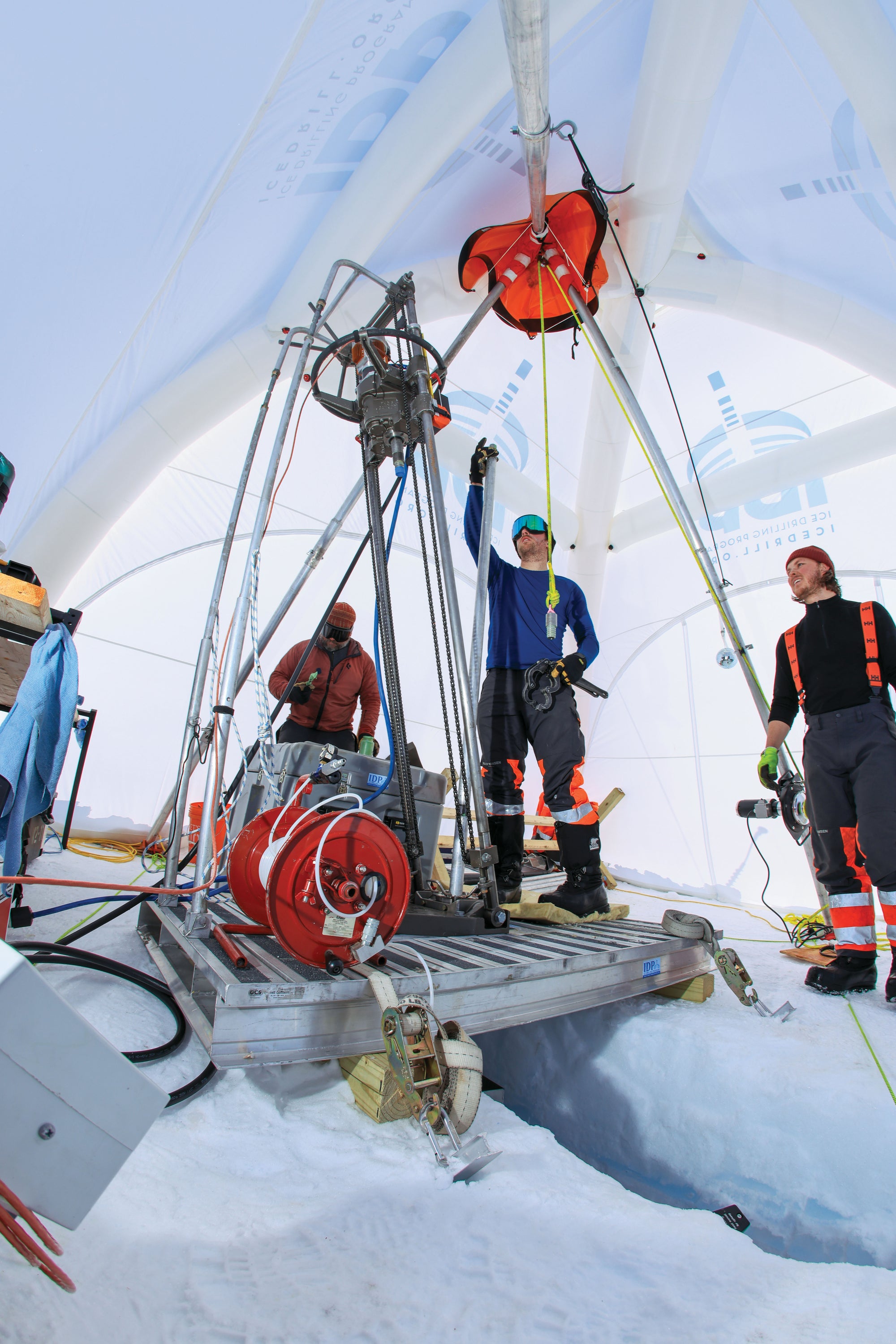
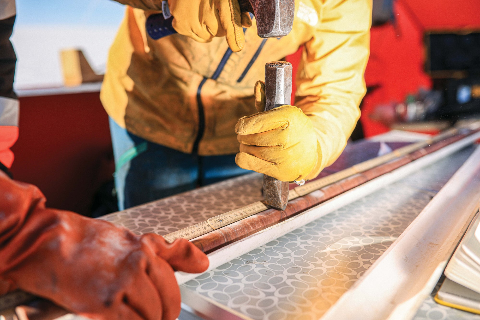
Team members Tanner Kuhl, Forest Harmon and Elliot Moravec (left to right) operate the Winkie Drill at the GreenDrill field camp. The drill is designed to cut through both ice and rock.
Elliot Moravec, the mechanical engineer monitoring the drill-fluid pressure gauge, smiled, but only slightly. It seemed like something was about to go right, finally—in an expedition where almost nothing had before the team made it to the ice. So much in the weeks leading up to this moment had been uncertain. There were logistical delays and failed landings by military cargo planes. A more ambitious plan, which included a much larger drill and two different sample sites, had been scrapped. The project’s two principal investigators were both forced to forfeit the field season at the last minute. One of them had come all the way to Greenland only to have to turn around. The other made the painful decision to not even try to make it to the ice. The rest of the team was marooned for weeks in Kangerlussuaq, a staging location on Greenland’s southwestern coast, about 850 miles from the drill site. Then it had taken more than 10 flights over seven days to get them and tens of thousands of pounds of gear onto the ice.
But at this moment, with just two weeks remaining in the expedition, their bit sat at the edge of discovery. The zone below was thought to hold within it a revelation: frozen in stone was a picture of this place but ice-free. Knowing the last time this area was actually green would help scientists answer a question of enormous consequence: Is the Greenland ice sheet even more fragile than we know?
Since President Donald Trump announced his administration’s desire to “get” the world’s largest island, Greenland has been the subject of sudden global attention. Climate change is exposing land formerly covered by ice, heightening political tensions on the island nation—and in the waters surrounding it as sea ice also disappears. But although the administration’s plan to extract Greenland’s natural resources is new, the American desire to occupy it, and pull value from underneath its frozen heart, is not.
In 1956 and 1957 the U.S. Army Corps of Engineers Snow, Ice and Permafrost Research Establishment, or SIPRE, recovered the first long ice cores from Greenland. Europeans and Americans alike had been trying to cross and dig into the ice sheet for decades before then. The “father of continental drift” himself, Alfred Wegener, is still entombed there. Wegener made four expeditions to study Greenland’s ice in his lifetime. During his final expedition, in 1930, he died out on the ice. Just before he became a part of the ice record, he wrote: “We are approaching a new era of polar exploration characterized by the successful utilization of new technologies in a rational manner. Everything that we want to and can measure must be measured on the ground.”
In 1956 American scientists were doing exactly that, but the reason they were there at all had as much to do with the cold war as it did with the cold ice. The government’s real mission was to build Arctic capabilities so it could both operate and listen from somewhere much closer to the Soviet Union. The location where SIPRE pulled those first deep ice cores from was called Site 2, and despite its public science mission, it was also a top-secret radar installation watching 24-7 for Soviet threats. But the tense geopolitics allowed a scientific discovery that, until then, had seemed impossible: the recovery of deep ice cores that kicked off an international race to recover and interrogate deeper and deeper ice. Those ice cores, and all that would be collected after them, became a kind of high-resolution climatological bedrock on which much of our understanding of rapid climate change rests.
Although it is difficult to count the number of ice cores in existence, adding up the length of ice in just the freezers owned by Denmark (Greenland is an autonomous territory of the Kingdom of Denmark) and the U.S. gives you more than 21 miles of ancient ice. Researchers have dated them, measured the pressure of their enclosed air bubbles, characterized the structure of their snow, detected ancient volcanic cataclysms in their particulate content, and more. The results have given us an indirect way to track the timing of large and abrupt shifts in climate as far back as 123,000 years ago in the case of Greenland and 1.2 million years ago for ice extracted from Antarctica. “They are basically a backbone of climate science in terms of giving us these continuous, high-resolution climate records,” says Joerg Schaefer, GreenDrill’s co-principal investigator.
I have a personal 25-year history with one of these backbones. As an undergraduate researcher, I lived for a month on an oceanographic research vessel off Baja California. The mission was to collect sediment cores from the ocean floor. I spent hours and hours taking measurements—more than 30,000 of them—with my face pressed close to stinking, methane-rich mud.
Like ice cores, the sediment cores had visible horizontal bands. Ice cores’ bands come from seasonal variations in snowfall; in this marine mud, the winter sediment from above showed up one color, the summer sediment another. I used a measurement technique that allowed me to pull a climate signal out of the alternating light and dark bands. But to confirm that those climate wiggles were real, I had to try to match what I saw with other records that climatologists were really sure showed a strong connection to the hot and cold climate swings of the past; enter Greenland’s ice cores.
In 1999, when I was doing my research, the gold standards for such climate-record wiggle matching were ice cores from the Greenland Ice Sheet Project 2 (GISP2) or from the Greenland Ice Core Project (GRIP). These two projects were a kind of friendly arms race between two different teams—one led by scientists in the U.S. (GISP2), the other by researchers in Europe (GRIP)—but without all the cold war skulduggery. Starting at nearly the same time (the Americans got a one-field-season jump on the Europeans), the two projects, less than 20 miles from each other near the summit of the Greenland ice sheet, raced to the bottom of the ice.
In July 1992 Europe won. That team reached the bed nearly 10,000 feet below the surface and stopped at the end of the ice. When the U.S. group finished a year later, not only did its core reach deeper than 10,000 feet, but the scientists were also able to collect a five-foot-long core of some of the rarest rock in the world—rock from under an ice sheet.
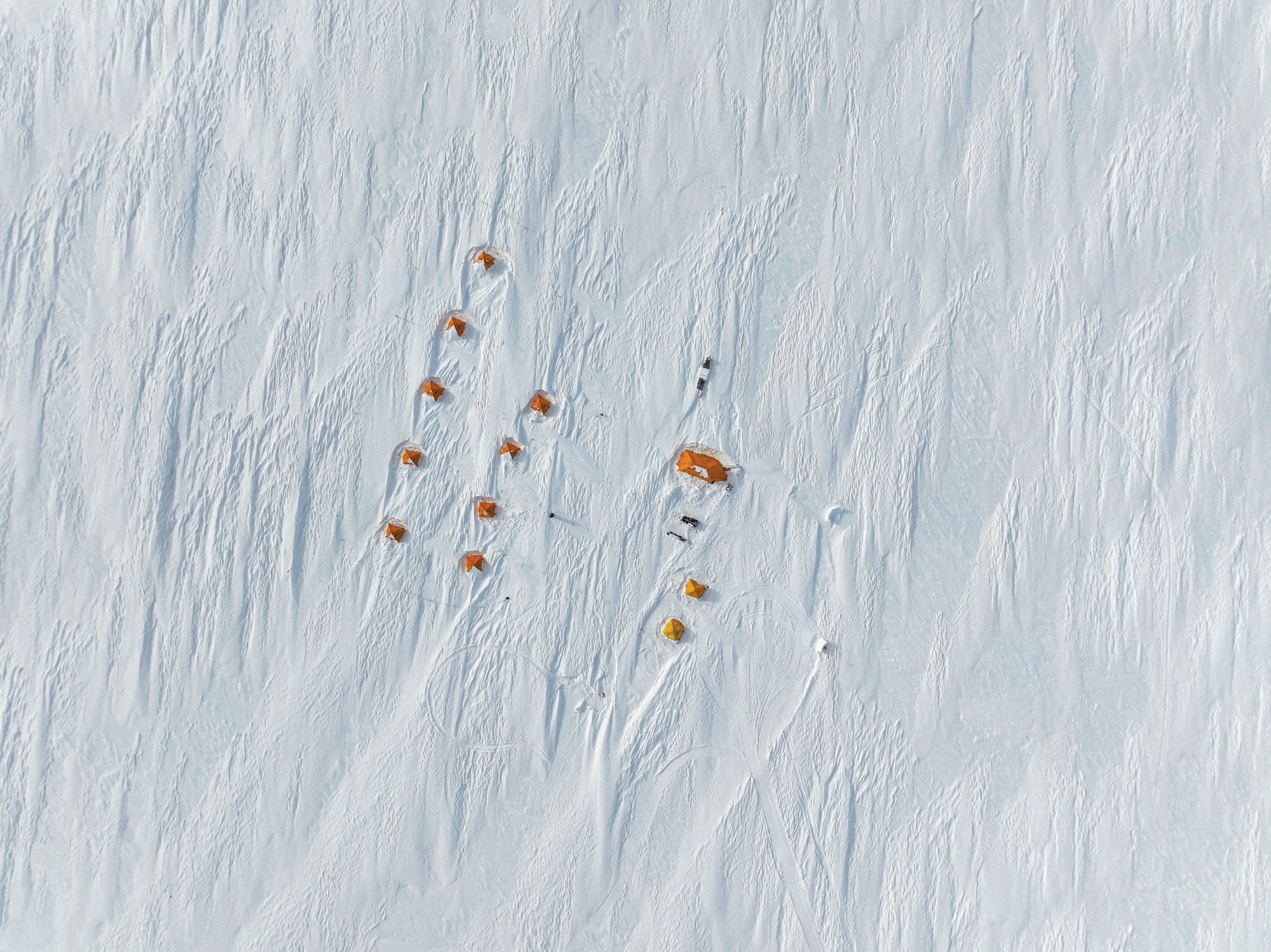
A drone’s-eye view of the windswept GreenDrill camp.
These two deep climatic records became standards to benchmark other records against. My mud record stretched from the present back to about 52,000 years ago. I could take that record of wiggles from dark (cold world above) to light (warmer world above) and see whether the same temperature-related wiggles pulled from the ice core matched up. They did.
Many other climate researchers saw the same thing. In the three decades since these two cores were pulled from the ice sheet, tree rings, coral, cave deposits, other sediments and ice cores from across the world have all been successfully wiggle-matched to the records.
But in all the years researchers spent hunting for ice and finding out all they could about its nature, they mostly neglected to interrogate the stuff the ice is sitting on. That is a critical gap in our knowledge that is just waiting to be closed. “Those bed materials, whether it’s sediment or hard bedrock contained within it, are the words, the stories of the history of the ice sheet—it’s a book of information down there that we want to read,” says Jason Briner of the University at Buffalo, the other co-principal investigator of GreenDrill. “The bedrock under ice sheets is the least explored remaining zone on Earth’s surface,” Schaefer says. “These are moon rocks for us—the most rare and the most hard-to-drill surface rocks anywhere on Earth—and we have practically no direct observations.”
Schaefer and Briner have spent more than a decade fixated on this deep gap in climate science. What they have already found is sobering. “I have, for the first time ever in my career, datasets that take my sleep away at night,” Schaefer says. “They are so direct and tell me this ice sheet is in so much trouble.”
Jen Christiansen; Source: Jason Briner/University at Buffalo (scientist reviewer)
The data that terrify him come from the rock collected in 1993 under the GISP2 ice core. The ice core went off to be immortalized in thousands of research papers as a centerpiece of climate science. The bedrock went into cold storage in the U.S. ice-core repository in Colorado. There it sat for almost two decades. In 2016 Schaefer, Briner and their collaborators exhumed the rock core and read it like a buried history book. They published a research paper in Nature entitled “Greenland Was Nearly Ice-Free for Extended Periods during the Pleistocene.”
The Pleistocene, a period that includes the last ice age, stretched from around 2.6 million to 11,000 years ago, when woolly mammoths, saber-toothed cats and the first modern humans roamed over earth and ice. From that one sub-ice rock core, the researchers learned that during that epoch there were periods—at least one, possibly many—when the ice sheet was completely gone or nearly so. “You do one data point, bedrock underneath the thickest part of the Greenland ice sheet, so you basically have to melt the entire ice sheet to make that spot ice-free,” Schaefer says. “Even there the bedrock was telling us, ‘Hell, yes, I was ice-free a lot over the last geological period.’”
“It started what some people like to call the fragile Greenland hypothesis,” says Paul Bierman, an author and geoscientist at the University of Vermont. Bierman and others have found additional evidence to support the worrying idea. In 2023 he and his colleagues published a study that showed “multiple lines of evidence” indicating much of northwestern Greenland was ice-free around 400,000 years ago. The concentration of carbon dioxide in the atmosphere then was less than 300 parts per million. Today we’re at 428 parts per million.
The GreenDrill team is preparing to publish new findings that are even more unnerving for humanity. Caleb Walcott-George, soon to be an assistant professor in the department of earth and environmental sciences at the University of Kentucky, was a graduate student during the first two field seasons of the project. At a recent academic conference, he presented solid evidence that an area in northwestern Greenland three times the size of New York City and currently covered by ice a third of a mile thick was either completely or nearly completely ice-free as recently as about 7,000 years ago. That corresponds with a time called the Holocene Thermal Maximum, when temperatures were just a few degrees warmer on average than they are now. Walcott-George says that’s within the range of warming we might experience by 2100.
Polar survival specialist and guide Gíslason uses a Shaw portable drill to bore through solid rock on a nunatak on the Greenland ice sheet.
Not long after Moravec sensed that the drilling rig was on the verge of core break, the team pulled its first sample of the season up from 165 feet below. Minutes later the core sat inside the capped inner core barrel, ready for inspection.
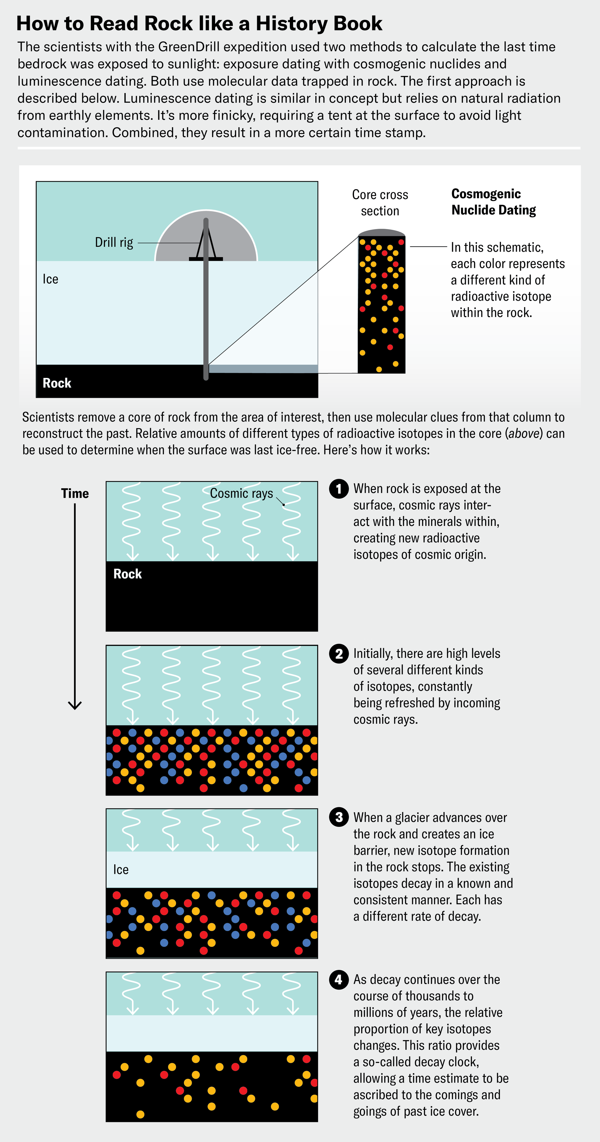
Walcott-George and Allie Balter-Kennedy of Tufts University stood shoulder to shoulder in a small, blacked-out tent originally designed for spearfishing pike over a frozen lake. The only light was a dim tangerine glow coming from a single LED strip taped to the ceiling. Balter-Kennedy and Walcott-George screwed off the drill head at the end of the barrel, tipped the tube up at an angle and gently shook it to get the material inside to slide out into the tray. This rock could tell them when it last saw the light of day. It also “remembered” how long it had been buried. But that memory was delicate, and even a flash of sunlight could throw it off.
Certain minerals in the rock act like batteries by “charging” when they are buried. Radioactive decay in elements surrounding the grains strips their electrons, causing the grains to luminesce, although the rocks don’t visibly glow. “We can determine essentially the charge rate, and by doing this we can figure out how long these quartz and feldspar grains have been buried,” Walcott-George says. But even seconds of sunshine can reset this signal, so every time a piece of rock is unearthed from below the ice sheet, they return to the blacked-out tent.
There is another source of stored memory in a subglacial stone, and it originates inside the hearts of dying stars. The cataclysmic explosions that mark the death of a star throw cosmic rays across the galaxy. Those rays blast their way to Earth, creating a cascade of elementary particles that buffet the planet’s surface. “When they interact with rocks, they create these nuclear reactions that create isotopes or nuclides that we don’t otherwise find on Earth,” Balter-Kennedy explains. “We know the rate at which those nuclides are produced. If we can measure them, we can figure out how long that rock has been exposed to these cosmic rays—or, in our field, how long that rock has been ice-free.”
It’s called surface exposure dating, and it works by revealing the total amount of rare isotopes in the rock sample. Over time, periods of sun exposure and burial create on/off spikes in the total amount of nuclides in the rock, with exposed being “on” and covered being “off.”
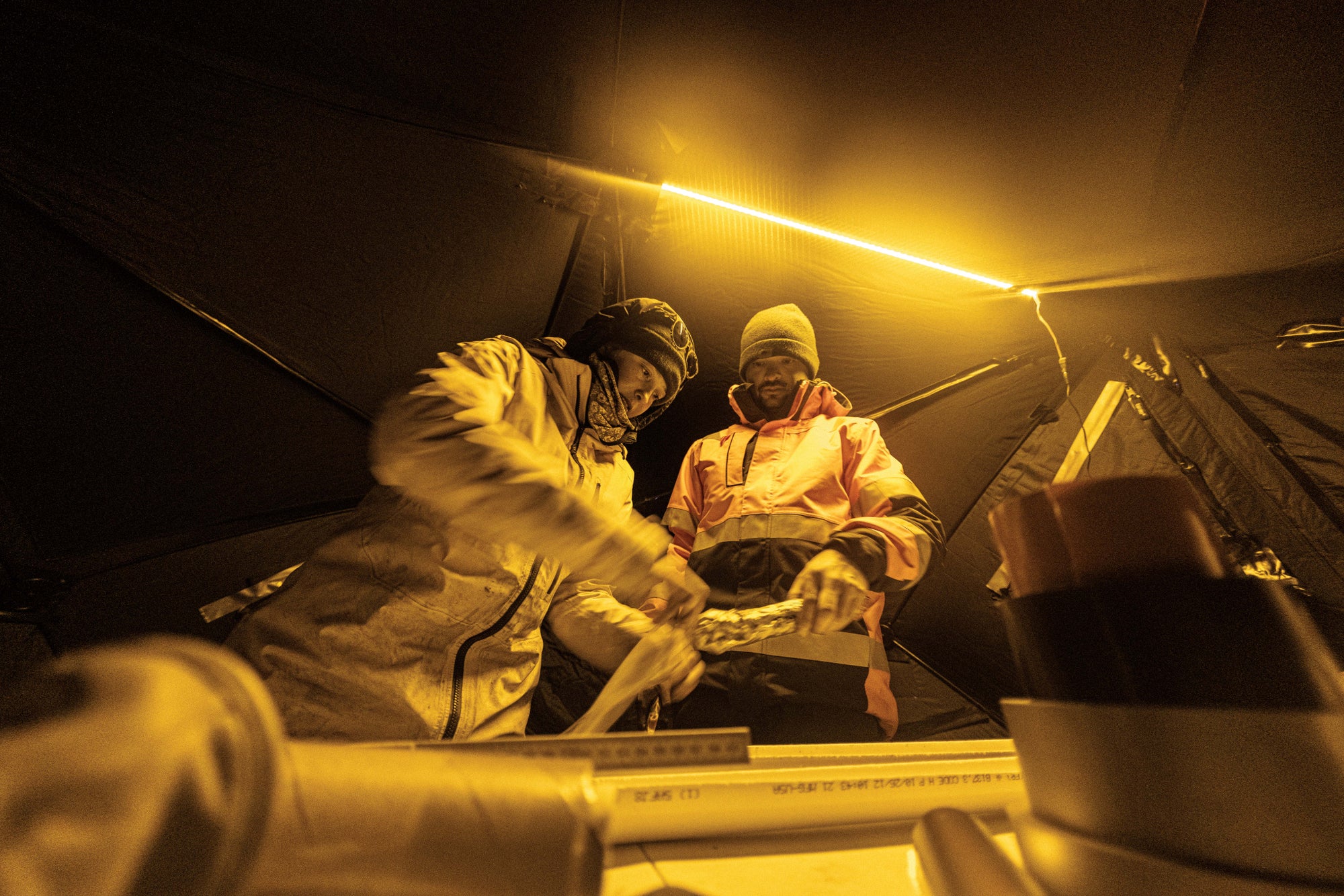
Allie Balter-Kennedy, now at Tufts University, and Walcott-George, soon to be at the University of Kentucky, measure and package a core sample in a blacked-out fishing tent. The samples have to be protected from contaminating sunlight, which would throw off the climate signal the researchers are trying to extract.
If researchers take two of these nuclides—say, beryllium-10 and aluminum-26—and measure their relative levels along many feet of a rock core, they get what’s called the decay clock. This clock runs down as each isotope decays at a different, predictable rate. When scientists see parts of the rock record where the clock has gained time, they know that the surface saw the sun. When the sample is buried, the clock slowly loses time in a countdown to zero cosmogenic nuclides.
The two methods allow the scientists to interview the bedrock, so to speak. “You ask: When have you been ice-free? For how long? And how many times have you been ice-free in the recent geological past?” Schaefer says. But that day in the tent it appeared that there might be no bedrock to interview. The core they had pulled up wasn’t quite right.
“Where’s that smooth bed?” Walcott-George asked, referring to the solid bedrock pay dirt they were looking for.
“I feel like it’s gravelly ice, and then …” Balter-Kennedy trailed off.
“Dirty ice,” Walcott-George said, completing the thought.
They decided they’d try again tomorrow.
Approximately 5,500,000,000,000 tons. That is how much water weight the Greenland ice sheet has lost to the ocean since just 2002. Sequentially dumped into Olympic-size natatoriums, it would provide a personal 660,000-gallon lap pool for every person living in Africa and Europe—all 2.2 billion of them.
But how, exactly, future melt will bring more green to Greenland is one of the biggest questions that science has yet to answer. “The scientific community right now does not know how the Greenland ice sheet disintegrates,” Briner says. “We don’t know what the mechanisms are and how long it takes for the ice sheet to get to its teeny-tiny state.”
In discussions of Antarctica, the word “collapse” is now often associated with the loss of ice through ice shelves such as the Thwaites, a floating extension of the Antarctic ice sheet. Nearly 75 percent of Antarctica’s coastal ice is in ice shelves floating in water. But the fate of Greenland is believed to be tied to that of its ice streams, which are more like small tongues that ring the island and are confined by deeply carved fjords.
Dorthe Dahl-Jensen, a Danish ice-core climatologist, first came to the Greenland ice sheet in 1981. Back then, “no one was talking about global warming,” she says. When she told people she was drilling ice cores for climate research, they assumed she was investigating when the next ice age would arrive. In her four decades of working on this ice sheet, Dahl-Jensen has seen changes happen in real time. One day in 2012 she was on the ice—and it rained. “I saw it as a very pure sign of global warming that we actually got rain on the center of the Greenland ice sheet,” she says.
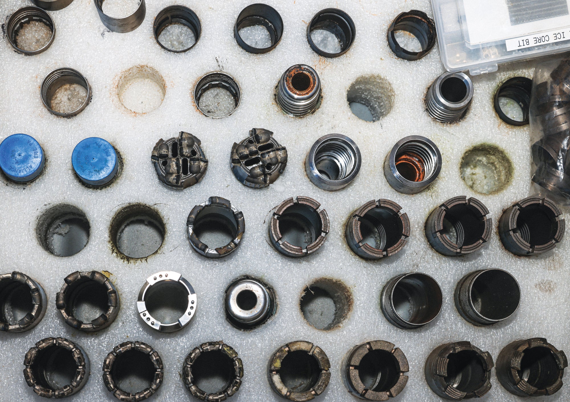
Some of the displayed drill bits for the Winkie Drill system are best for drilling through ice; some are for cutting through bedrock.
More recently Dahl-Jensen led research for the East Greenland Ice-Core Project, which in 2023 managed to pull a 1.5-mile-long ice core (and some subglacial mud and stone) from close to where the NEGIS begins. The entire process had taken eight years. “When you look at the balance of the ice sheet and how much it has lost, half of the extra loss is from melt along the coast of Greenland, but the other half is from acceleration of the ice in the streams,” she says. Dahl-Jensen knows that ice streams are a big factor in sea-level rise, but she’s also aware that we don’t yet know how they behave. “We are not capable of modeling them properly into our ice-sheet models,” she explains.
That is why the GreenDrill team wanted to get bedrock underneath the NEGIS from a site much closer to where it meets the coast. Measurements from each of these projects will feed into the mathematical models, which attempt to simulate how the real world works. “We have so many gaps in our physical understanding of how an ice sheet actually responds,” Schaefer says, noting that current models have big error margins.
Ice-sheet models work much like the climate models we use all the time—the ones that predict tomorrow’s weather. They use mathematics to simulate the interactions among real atmospheric phenomena: wind, pressure, moisture, thermodynamics, and lots more. They are reasonably trustworthy over hours to days because they are loaded with real data: historical data; measurements from weather satellites and balloons; and observations from land, sea and commercial aircraft.
Improving the ability of ice-sheet models to accurately predict how the sheet will respond to the warming it is experiencing now—and that yet to come—is no different. The models need data-based gut checks to make sure their predictions are informed and constrained by as much reality as we can feed into them.
Schaefer believes reducing the error will make ice-sheet models better tools for adapting to climate change. “If you are a politician and you want to make New York City—or any city that is close to the ocean—sea-level safe, you need precise predictions of what is going to happen,” he says. And those predictions will become increasingly vital as the world moves deeper and deeper into its climate-warmed future—a future that those who study Greenland fear will be societally altering.
“Think about the mass migration that will happen if we melt all of the Greenland ice sheet,” Bierman says. “That’s not tomorrow—that’s centuries from now and even millennia from now—but when that happens, that will be the biggest movement of humans ever because they’ll lose their farms, they’ll lose their cities, they’ll lose their homes,” he says. “It will be creeping and slow, but it will happen.”
The day after the heartbreak in the fishing tent, the team hit solid rock. It was what they had come for, and they found it just in time. A blizzard blew through camp hours later, shutting down drilling for the next two days.
When the work resumed, the team decided to try for a second core. This one would be half as deep as the first, so, the researchers reasoned, maybe they could get even more precious rock from under the ice to interrogate in half the time it took to get the first sample. All work had to be wrapped up within a week to leave them enough time to pack up for extraction. With good-enough weather, the twin-engine ski plane would be landing at the site, and it wasn’t going to wait for anything.
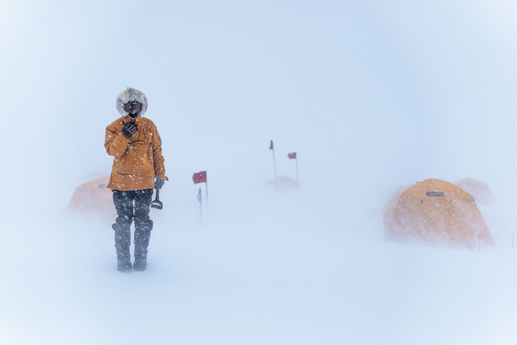
Barbara Olg Hild, the polar bear guard, stands in the GreenDrill camp during a blizzard that lasted for two straight days. During the team’s weeks in the field, two such storms would stop work for two to three days in a row.
Over the next two days they made good progress. Rather than setting up the drill tent all over again, they decided to chance a mostly unprotected drill hole. A small wind break was all that separated them from the wind and blowing ice. While Moravec, Harmon and Tanner Kuhl, the third and most experienced ice-drilling engineer, started again, the others fanned out onto the nunataks, dark peaks that broke through the ice-bound oblivion like the heads of whales surfacing through the ocean of ice. There Walcott-George, Balter-Kennedy and Arnar Pall Gíslason, the team’s survival guide, used backpack-size rock drills to take a core from the surface of a nunatak. The rock was constantly exposed to sun and cosmic rays, and the luminescence signal and cosmogenic nuclides pulled from it would provide the baseline against which the under-the-ice-sheet rock cores would be compared. Just as it started to look like they might have this victory-lap sampling in the bag, a second blizzard blasted through the site.
“Let’s get the hell out of here,” yelled Matt Anfinson, the camp mechanic. He emerged from the drill tent into a whiteout. The storm was still picking up. The drill tent, the only refuge aside from the mess and sleeping tents, was bowing ominously in the 50-mile-per-hour winds. It was time for the team to grope its way back to camp with only a line of red flags to guide it through the nearly zero-visibility conditions.
For the past three hours the group had been involved in a kind of mechanical open-heart surgery. The patients were two backpack drills that had stopped working during sampling on the nearby nunatak. The team had brought two to be safe; both had died. The drills lay on the worktable, guts exposed. After fiddling with the ignition coils, Anfinson ripped on the starter pulls. As one drill spun into high gear through smoke and sputter, he looked like an ice-field Dr. Frankenstein, gleefully and maniacally gazing on his reincarnation. It was a rare victory amid a “weather daze,” as Harmon, the driller, called it.
Balter-Kennedy breaks a bedrock core into pieces for packaging and shipment. This core was the last one the team collected before being extracted from the GreenDrill camp.
Living through blizzards like these feels like what you’d expect inside a sensory-deprivation white-noise machine. This latitude sees no darkness in May and June, but without a break in the gale-force winds, the conditions outside are both bright and blinding. Wind-sculpted snowdrifts grow through the field camp like giant, icy fingers. They block the doors of sleeping tents and make walking treacherous; you either trip on a three-foot-tall snow wall that wasn’t there hours before or fall off one into three feet of powder.
There was a cruel monotony to the continuous winds. They forced the crew into smaller and smaller circles of living—sleep tent to mess tent to bathroom tent and back. Barbara Olga Hild, the polar bear guard, fought through the long, bright nights to keep the electrified wire fence around the camp from being covered by drifting snow. Walcott-George sat in the mess tent brewing carafe after carafe of strong coffee and engaging in Arctic self-care, using superglue to seal his dry, cracked fingers against drilling fluid. Balter-Kennedy patched punctures and tears in her favorite polar bib and pored over her core-sample logbooks. Moravec and Harmon played cribbage for hours. Everyone skulked outside into the whiteout on rotation to fill an orange five-gallon cooler with snow to be melted on a camp stove for water (it is ironic how much effort it takes to make drinkable water when we are surrounded by ice).
Perversely, it was during the weather’s harshest moments that people used to working on the ice opened up about why they seek out the cold and the isolation of polar work. “The reason people go to the Arctic is [that] you can hear the silence,” Hild said. Dahl-Jensen, the Danish ice-core scientist, told me that the months of near-complete isolation from the rest of the world have become a prized part of the experience, worth any amount of cold and discomfort. “We live in our camp and do our research, and the time where you can only focus on one thing is really wonderful,” she said. That feeling—of slowing down, of concentration—is something many on the team told me they miss when they’re off the ice. “I always dread the end of a field season,” Balter-Kennedy said. On the other side is the stark return to normal life, the avalanche of unanswered e-mails, the fact that things are different than when you left them.
When the storm finally cleared after three days, the team practically launched through the tent opening to get back to work. Because of the blizzard, they had just two full days to complete the new drill hole. The first core took a week to get, and that was without any weather delays. Everything had to go right now.
Just one day later the entire team was standing around the drill and taking in the last sample before packing up. The drill had burned through almost 70 feet of ice. The weather was sunny. The day felt unseasonably warm—about 15 degrees Fahrenheit above freezing—and the team easily cranked through the last drilling run. As the last rock core entered the bottom of the barrel, the sounds of the rock band Ween floated out onto the open ice.
The core came up clean. The team closed the hole with a cheer and a small pour of the Danish liqueur Gammel Dansk, or, as it was better known here, “driller’s fluid.” It wasn’t for the crew. “You were a good hole,” Harmon said as Moravec poured booze down to the bedrock.
Walcott-George hoisted the final rock core like a prize striped bass. Then, as they had done all season, he and Balter-Kennedy noted its lengths and features and stored it for transport, not yet knowing what story of Greenland’s ice-free past, and our flooded future, it might tell.


